Wish list

Ticking off places to visit
Andrei has developed an interesting habit – I call it “I-want-to-go-to-itis“.
The other day, for example, he was introduced to somebody, a visitor from Norway, and when he came home asked me, “where did she say she was from?” ”Norway,” I replied … and he turned on the computer and Googled “Norway” … then switched to Google images and cried out “Wow! I want to go there!”
He has been doing that quite a bit recently … and about some surprising places … and it can be quite frustrating – especially as he chooses places which are far away and it’s difficult to see how he achieve his dreams in the near future, … (at least Maxim is a little more realistic and chooses places a little closer to home, like Ala Archa, Kegeti and Son Kul) … but, to be fair, I know how he feels.
Way back when I was at school and studying South America, I was so taken with the images of Brazil and the Amazon Rain Forest got a hankering to go there … unfortunately, I never made it … I did get to some of the other places I was inspired by, (New York, Paris, New Zealand, Sydney – albeit a flying visit, literally, Tahiti, Vienna, to name just a few), but there are many that I never made, (Antarctica, the Grand Canyon, Jerusalem, New Orleans, the Pyramids, Venice, Washington, … the list go on … and on … believe me.)
In fact, when faced with an “I want to go to …”, I sometimes feel that I want to respond with “Yes, and I want to go into space and walk on the moon … but I doubt that I’ll make it”, but then, if Richard Branson has his way … then who knows what might happen. After all … my first “foreign holiday” came from such a comment … having been asked where I would like to go, I happened to see an advert for Norway in the paper and thought how I often had hankered to go and see a fjord, a glacier and go into the arctic circle and the “land of the midnight sun” (… as it happens, I never made the arctic circle – but I made the other two!)
Besides, I suppose that it would be wrong to dampen his enthusiasm.
When it comes to Kyrgyzstan, although I have been to lots of places around the country, there are still many that I have yet to visit and elicit a cry of “I want to go to …“.
For example, here are a dozen places on my personal wishlist:
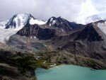
Lake Ala Kol
Ala Kol Lake: which is on the popular trekking route between Altyn-Arashan and the Karakol gorge at an altitude of 3532m. It is often the first overnight stop on the route between Altyn Arashan to Djety Oguz, but it can be reached in a (long) day from either of the Alyn Arashan or Karakol valleys – but only in the summer months – and, although the trek is popular, the route is not regarded as “easy”. It is set in a barren, rocky depression and surrounded by the peaks of the Terskey Ala Too range. The lake is approached along rocky paths and scree slopes. The lake is 2.3 km long and 700m wide which makes it the largest of the 729 lakes in the Issyk Kul basin. No one seems to know how deep it is, at least, (I can’t find a record of its depth anywhere in the literature), but the Encylopedia Kyrgyzstana says that the volume is 4.3 million cubic meters. The crystal clear waters of the lake are fed by glacial streams and the outflow forms a waterfall. It freezes from October until May. The lake’s colour changes according to the time of day, the season and the weather – the waters can seem violet, dark blue or even pink.
.
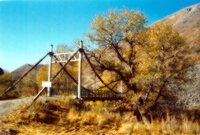
The entrance to Besh Aral
Chatkal – and the Besh Aral Zapovednik: Located in the Western Tien Shan mountain range, the River Chatkal flows for 189 kilometers in a remote valley in the extreme West of the country. It is flanked by the 120 km long mountain range of the same name and the Chandalash range. The Chatkal river used to be used for rafting expeditions, (although border problems with Uzbekistan have limited recent expeditions) and the mountains are used by athletes from the former Soviet countries for ‘high altitude’ training and the mountain slopes are often used by skiers.
The Besh-Aral Zapovednik (Bio-diversity Reserve) is situated in the Chatkal Valley of the Jalal-Abad Oblast 340 km from Jalal Abad the oblast centre and 25 km from Kanysh-Kiya the Chatkal Rayon centre.
.
Chil Ustin: To the West of Osh, near the Uzbek border is the village of Aravan, in the limestone hills that make up the foothills of the Ak Bura and Aravan river basins, lies the Chil Ustun cave system that is named after the stalactites that can be found here, (Chil Ustun is Tajik and means “40 columns”).There are other systems which riddle the hills around here. The main cave of Chil Ustun is 380 meters long and consists of three spacious halls connected by narrow, winding corridors. The third chamber is over 100 meters long, 20 meters high and at its widest point over 50 meters wide. From the ceiling hang stone “chandeliers”, the walls are covered with tinted crystals, numerous ancient drawings and inscriptions in a variety of languages including Sanskrit. The crystals react by producing different sounds when the wind blows. It is thought that the caves have curative properties.
.
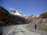
The road to Irkeshtam
Irkeshtam: There used to be lots of places where people crossed the border between Kyrgyzstan and China but now there are only two official border crossings: Torugart and Irkeshtam. Although the Bedel and Taldyk passes are on my list but Irkeshtam is higher on my list probably because we actually send people over the pass and so I have seen lots of photographs of the incredible scenery. The road is undergoing reconstruction now making it a far easier journey than it used to be …
.
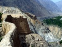
The Kan fortress
Kan: The Kan Fortress stands above the village of Abkol on the Sokh River. It was an important fortification of the Kokand Khanate in the 17th century and is still reasonably well preserved. It is divided by a deep hollow into two distinct parts which were connected by a bridge. Where the bridge meets the larger of the two fortifications were two conical towers. The smaller of the two parts, nearer the mountains, may have been a pen for holding livestock, etc. In the courtyard is a stone engraved with images of animals and and men riding camels – perhaps depicting a connection with travelers along the Great Silk Road. This stone predates the fortress itself.
.
The Kan-i-Gut page
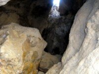
Kan-i-gut: Eighteen kilometers from the settlement of Samarkandyk, in the Batken oblast, on the slopes of a spur of the Turkestan ridge of mountains, lies the mysterious and legendary cave of Kan-i-gut. From as early as the 10th and 11th centuries silver and other minerals were extracted from the caves … and at one time the cave was known as the “Mine of Death”. In the days of the Kokhand Khanate, criminals sentenced to execution, political enemies of the authorities and others were sent here to work in the mines. They were turned loose in the labyrinth of caves, which stretches for over three kilometers, and if they returned without ore of the precious metals, they were either killed or sent back to look again. Once they entered the caves – there was no way to emerge again. Many invented tales to astound their goalers - and hopefully earn themselves a release – including stories about a sleeping camel with jewels as eyes, a mysterious green plant that grew underground, walls made of silver bricks, and terrible creatures which acted as guardians protecting the caves treasures. The mines are now all but exhausted.
.
Kashkasuu and Piramida Peaks in The Karavshin gorge
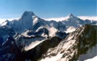
Karavshin: The Karavshan Mountains form a narrow east-west spine of granite, about 15 miles long, among the usual shale and limestone peaks of the Pamir Alai, on the border of Tajikistan, Uzbekistan and Kyrgyzstan. Sheer and massive rock formations cut by vertical cracks and to many people they are reminiscent of rocky canyons in America, Patagonia and elsewhere. Rarely visited by locals or visitors alike, wild life reigns supreme in this area. The few human visitors that do descend on the area tend to be either local shepherds and herders bringing their animals to the lush green pastures; the occasional miner working the deposits of mica, tin or other minerals (during the early parts of the twentieth century – the mine works have now been abandoned); and mountaineers intent on exploring virgin territory, (not all of the peaks in the area have been conquered). However … access to the area is difficult – passing through enclaves.
.
The Kegeti Waterfall
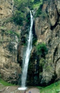
Kegeti: Ninety kilometres East of Bishkek lies the Kegeti valley with steep forested slopes. A two or day three trek takes you up the Kel-Tor gorge, a side valley, to the Kel-Tor lake (Dead Lake) with it’s turquoise water and numerous beautiful waterfalls. From the valley you can visit the Bel Saz jailoo, the Sharkyratma waterfall, Kushkonok forest, Kisl Beles forest, Chaunde Gorom viewpoint and Kara Unkur (Crying cave). It is also possible to make a trip into the neighbouring Tuyuk valley and Karagai Bulak.
.
Kol Suu: Kol Suu lake is one of the most beautiful alpine lakes in Kyrgyzstan, at an altitude of 3600 meters above sea level. It was formed as the result of strong earthquake which caused a rock slide which blocked the upper Kurumduk river that flows into the Ak-Sai valley, in the Naryn region, near the border with China. The Ak Sai valley is one of the most remote spots in Kyrgyzstan, but it is also in the border zone which means that special permits are needed to get there. Also, there is no road to the lake, but it is possible to get there using jeeps or on off-road vehicles.
.
Peaks and glacier
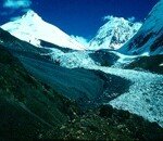
Peak Pobeda, Khan Tengri the Enilchek glacier and the Mezbacher Lakes: The peaks are two of Kyrgyzstan’s highest mountains at over seven thousand meters. At their foot is one of the world’s largest glaciers which plays host each summer to one of the country’s most mysterious geological phenomenon, the Mezbacher Lakes, which form and then suddenly disappear as the waters drain away … and nobody knows why.
.
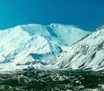
Peak Lenin
Peak Lenin: In the Osh oblast lies on the border with Tajikistan – it rises to a height of 7134m and was the third highest mountain in the former Soviet Union, shaped something like a “high armchair”. The outline, however, is not always obvious because the summit is almost always covered in cloud – and it is necessary to look at it over a period of time to make out the profile. The peak takes the form of a pyramid with a large base – the northern slope being very steep compared to the others.
.
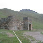
Tash Rabat
The road from Tash Rabat to Baetova: Tash Rabat is one of my favourite spots in Kyrgyzstan. Although it is often visited on the way to or from Kashgar in China, for those not crossing the border, a visit to Tash Rabat tends to involve travelling there and back along the same route. We are always on the lookout for alternative routes and it happens, there is one … but the road can be a bit “difficult”, especially if there has been rain, because it involves crossing a couple of fords and the streams can get swollen, As it happens, every time I have tried to do the route, it’s rained and I have had to turn around.
.
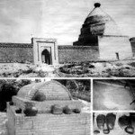
Safed Bulan
Safed Bulan: In the Moslem graveyard, on outskirts of the village of Safed Bulan is the brick mausoleum of Shah-Fazil, reputedly built by his son around 1050 AD. Shah Fazil is reputed to have brought Islam to Central Asia. It is still an operating Sufi mosque and pilgrimage site..
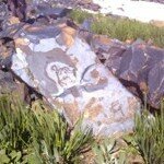
Saimaluu Tash Petroglyph
.
Saimaluu Tash: Hidden at over 3000 meters in the Ferghana range, about 100 km northwest of Djalal Abad, near the Kurgat Pass is the remote, small plateau of Saimaluu-Tash. The name means “Patterned stone” and refers to the fact that here is a gallery of thousands of stone paintings – petroglyphs which are littered around the landscape.
.
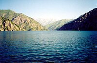
Lake Sary Chelek
Sary Chelek: Lake Sary Chelek is said by some people to be not only beautiful but their favourite spot in Kyrgyzstan. I have never actually made it to the lake, although I have been close … in the neighbouring valley, but time was short and I thought to myself that I could always go back another time, so we turned around and returned to Bishkek.


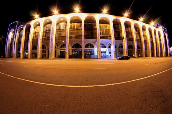


 Bishkek