Kara Balta – Black Axe
Kara-Balta is one of the youngest cities in Kyrgyzstan, formerly established in just 1975.
The name Kara Balta means “Black Axe” in Kyrgyz. The town is just over 60 kilometres to the West of Bishkek, at the junction of two main roads : The main Bishkek–Taraz (Djambul)–Tashkent road and Kyrgyzstan’s main North-South highway, the Bishkek-Osh highway which climbs through the gorge of the Kara Balta river over the Too Ashu pass into the Suusamyr plain.
Although the city may be one of the youngest cities in Kyrgyzstan, having been formerly established in just 1975, it stands on an ancient site with a long and colourful history.
In the plain leading up to the foothills, south of the road between Kara Balta and Bishkek are Barrows (burial mounds), some of which date from the centuries Before Christ. There is also the site of Karan Zhuvan – an ancient settlement dating from between the 6th and 12th centuries.
Kara Balta itself was built close to the ruins of the ancient city of Shish Debe – one of the oldest known settlements in Northern Kyrgyzstan, which disappeared sometime in the 15th and 16th centuries. Scholars sometimes identify it with the ancient Silk Road city of Nuzket. Various surviving sources, both Arab and Chinese, indicate that the city was a significant medieval settlement.
Archaeological excavations have revealed a huge city, consisting of a citadel and shakhristan with total area of about 1 square kilometer which was located on the site of today’s lower market. The city itself seems to have covered about 6000 hectares … and encompassed several of the present day villages of Alekseevka, Kalinin, Fedorovka, Novonikolaevka, Jacken, Iri-Suu, Sary-Koo and the northern part of what is now the city of Kara-Balta.
The Citadel would have towered over the rest of the settlement and would have housed the castle of the local ruler, the most important public institutions, farm buildings to serve the “royal” family. In the Shahristan, a ring-surrounding the citadel, were concentrated the estates of the nobility and officials, the mosque and bazaars.
Archaeologists have also discovered a large collection of coins, one of the largest in the region consisting of some 800 coins made of silver and copper and dating from the 11th and 12th centuries. Although pottery and ornate jewelley seems to have been manufactured locally, there doesn’t seem to have been any “industrial” center or workshops, agriculture being the predominant economic activity. There seem to have been several farmsteads, with channels both for irrigation and for the redirection of flood waters.
The city was surrounded by a long perimeter wall, taking the shape of an irregular polyhedron and stretching for more than 12 kilometers. Part of what remained of this wall was destroyed during the construction of reservoirs and ponds of the sugar factory. There was a second system of fortification, covering an area of approximately 50 km. In the woods were strengthened, powerful towers defended with a drawbridge. Indeed, there is evidence of four fortification s of walls, suggesting that the city was built four times.
Despite these defences, the city disappeared and was burned to the ground – the site being abandoned for something like six centuries until the time of the Kokhand Khanate under the Khan Madelina, when the fortress of Shish Debe was built. It was clearly a major fortress, the center of the local defenders of the Western Chui valley, providing food, clothing and accommodation for troops.
In 1863, however, an open dispute between the Kokand Khanate and the local population erupted, and the fortress at Pishpek fell to a the Kyrgyz and a Russian force from neighbouring Verney, (Almaty). Russian settlers began to arrive in the region and many settled along the banks of the Kara Balta River. In 1874 there were already more than a hundred and others continued to arrive, including emigrants from the Ukraine.
The fortress was still standing in 1893-4 when the Russian VV Barthold wrote an account of his travels through Central Asia. The fortress of adobe bricks had been surrounded by impassable marshes although they had already started to dry out. He reported that some of the locals attributed the settlement fo Shish Debe to no other than Solomon, but he felt that the forts were much more recent and were likely to have been built by sarts, (town dwellers).
By 1912 the population of the village had grown to over 2000, living mainly in squat houses made of adobe brick and roofed with thatch made from reeds. There were some small handicraft businesses, water mills, an oil press, cobbler, tailor a coopers and a blacksmith’s forge. In 1924, the construction of the railroad helped to put Kara Balta on the map facilitating the growth of industry and the transport of both raw materials and finished products. Perhaps, however, the biggest change in 1933, (on March 8th), with the opening of the Sugar Mill which brought with it a number of subsidiary support services and industries, such as heat and power.
In Soviet times it was a closed city because the uranium and other metals that are found in large deposits in the neighbourhood were mined for military purposes. Because of the development of related industries, it took on a prosperous economy with well developed infrastructure, pretty buildings, tree lined streets and a generally Russified feel. The part of the town, which was “closed” is called Pochtoviy. There is a park with plenty of trees and the inevitable statue of V. I. Lenin.
Kara Balta is also the name of one of Kyrgyzstan’s bestselling brands of Vodka. Not surprising, because the town is home to the Bakai factory, which produces many different types of foodstuffs, but most notably – Vodka.
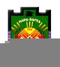
Kara Balta's coat of arms
The city has its own coat of arms, (gerp), and its own hymn or anthem.
The coat of Arms was adopted in 2000, in order to commemorate the city’ 25th anniversary. The emblem was selected in a competition in which there were a total of 89 entries … the two winning entries were then combined by the Chief Architect into a single composite design.
The emblem symbolizes the strength and shield, recalling the crenelation of an ancient city wall at the time of the Great Silk Road. The colour, green, was chosen to symbolize life and constant renewal.
In the center is of the gerp is a tyunduk – the traditional symbol of peace and the relationship with the cosmos in the mythology of ancient Kyrgyz culture. Through the tyunduk there are visible three snow-capped mountain peaks of the Alatoo mountain range, illuminated by the rising sun, and emphasizing the unique nature of the land. To the right and left are ears of wheat, indicating the development of processing industries in the region, whilst below the tyunduk merges with the cogs of gear wheel, (or pinion wheel), reflecting the development of industry.
At the top of the shield there is an image of a galloping horseman - Baatyr Karabalta. The name of the city is cast by rays of sunlight, which highlight.
Along the bottom edge of the symbolic shield is 1975, the date of formal incorporation of the city along the bottom edge are example elements of Kyrgyz national ornament.
The Hymn was also chosen as the result of a competition, this time to commemorate the 30th anniversary of the city’s incorporation, in 2005.
I’m not sure about the quality of the translation … but this is, roughly, what I am told it means:
Over the river in the palm of the valley,
Streets like deploying wings, bold and young,
Grow as a Baatyr in the epics,
My City, Karabalta , a city boy.
Chorus: Karabalta, Karabalta,
City of Light, the city of happiness, Karabalta!
Peaks above you painted in the morning,
In the golden hues of the highest standard,
For all their work, for a long time you’re fine,
And on all of the Silk Road, you are special.
Chorus: Karabalta, Karabalta,
Sun City, a city of friendship, Karabalta!
You’re rich, if people are thinking wisely,
You soldier and if you rise in anger, threatening,
You are great, from the beginning of time
Nobly reaching for the stars
Chorus: Karabalta, Karabalta,
City Light, the city of youth, Karabalta!
The legend of Kara Balta and Ketmen Tebe:
A long time ago, by the banks of the Naryn River, there was a mountain made of salt.
Nearby lived a mullah who was very rich and had lots of cattle and sheep. The main source of his wealth was the mountain of salt … he sold the salt. Unfortunately, as his riches grew, the more greedy and avaricious he became.
One day a peasant came to him and asked for some salt. “You must pay for this salt,” the mullah said. “But I have no money,” the peasant replied. “Then go away!” was the mullah’s response.
Aggrieved, the peasant decided to seek revenge. He was strong and skilful. He decided to build a dam to divert the mighty river, in order to wash away the mountain of salt – the source of the mullah’s income and power.
He took his shovel, (ketmen in Kyrgyz), and started to dig. He threw sand and stones into the river. But then, disaster struck. With one powerful sweep, his shovel broke. So, he took his axe (balta in Kyrgyz) which was black (kara in Kyrgyz) and started to swing that – but soon it became cracked and useless. In a fit of rage, he took the axe and threw it as far as he could. He was a strong man and his rage enhanced his natural strength and the axe flew high and far … way over the mountain range that lay to the North.
The place were the axe landed was later name Kara Balta – “black axe”, which is some 60km to the west of Bishkek.
The place by the river (now on the southern shores of the Toktogul Reservoir) where the mountain of salt was located was later called Ketmen Tebe – “The Hill made by a shovel”.
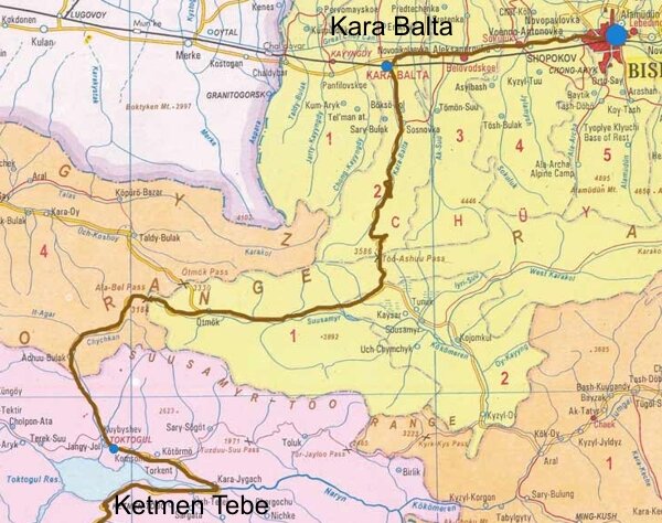
That was one mighty axe throw





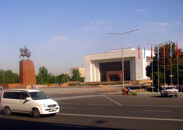
 Bishkek