Maps
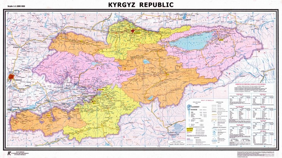
Administrative map of Kyrgyzstan published by the State Cartographical Agency
Maps are fascinating. I could spend hours pouring over them and every time I look at one, no matter how many times I have looked as a particular map, I am sure that I will find something new.
A map is a visual representation something, (usually a geographical area), symbolically highlighting relationships between things.
They normally used to represent in two dimensions, on a sheet of paper, the geographical location of places … although throughout history there have been a wide variety of styles and formats. The use of modern technology allows for even greater variety, such as 3D projections, GPS (Global Positioning Systems) and interactive maps, (such as Google Earth).
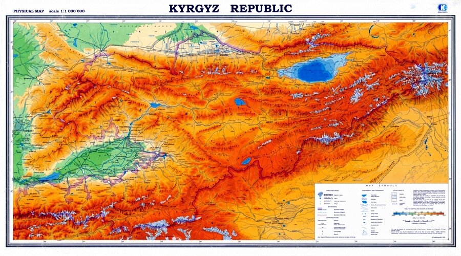
Physical map of Kyrgyzstan published by the State Cartographical Agency
It can be difficult to obtain detailed maps of Kyrgyzstan or of the Central Asia in general, although several are published in Europe. It should also be remembered that maps came with different scales, which limits the amount of detail they can show, and can be designed to serve different purposes.
A basic map should give a rough idea of the location of Kyrgyzstan and different places within the country, and help plan an itinerary. Guidebooks to the region or the country, (such as Lonely Planet, The Odyssey or Bradt guides) also contain basic maps. It is also possible to buy several different, locally published, maps here in Bishkek. As well showing the main features of the country, they usually have a lot of information printed on the reverse side.
Map of the Silk Road published by the State Cartographical Agency
Road maps are probably the most widely used maps today. There isn’t really a road atlas of Kyrgyzstan, however, although several have been proposed. One reason is that there are so few roads - separated by vast areas of mountain ranges. A problem with many maps is the accuracy, completeness or how up-to-date the information which is depicted. For example … many maps still show the A364 road which loops from the Barskoon valley south of Lake Issyk Kul through Kara Sai and Ak Shyirak to Enilchek and then Karakol – unfortunately this road is no longer usable as some of the bridges no longer exist.
Google Earth
It is also necessary, however, to remember that distances on the map cannot be automatically converted into travelling times. A lot will depend on things like the terrain, the condition of the road, the weather conditions, and how many stops you make, (for taking photographs, or eating, or …).
Confusion is also possible because some maps also show old names of settlements – which have a habit of changing – or use different spellings.
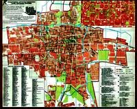
Bishkek Map
A road map is unlikely to show sufficient detail for a trekking expedition. Special “Trekking Maps” (in Russian) used to be available for many of the more popular trekking routes in Soviet times, such as across the Kungei Ala Too mountains between Almaty in Kazakhstan and Issyk Kul, (These routes are less widely used today, however, as technically it is possible to cross the border at designated border posts), between Altyn Arashan and Djety Oguz, (South of Karakol ), and between Talas and Sary Chelek.
Most guide books also contain “street maps” for some of the main city centres. There are several maps of Bishkek available, which are published locally.
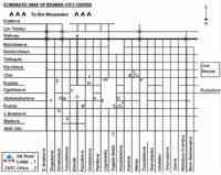
Schematic map of Bishkek
The State Cartographical Agency in Bishkek provide a variety of maps of different scales, for example (1:100,000 or 1:1,000,000). During the Soviet period, this was a Top Secret institution, part of a network of offices throughout the Union responsible for providing maps for all sorts of purposes. Together with the Academy of Sciences, they published the Atlas of the Kyrgyz SSR in 1987 which has many fine examples showing not just the relief, but also geological information, land use, water resources, and many other aspects of the geography of Kyrgyzstan. The also publish a map called “The Silk Road of Kyrgyzstan”, that shows the basic trading routes that were followed throughout what is now Kyrgyzstan and indicates about 120 sites of antiquity ranging from the sites of ancient settlements, burial mounds, major archaeological discoveries and petroglyphs.
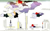
Graphical representation of Census Data from The Mountain Atlas of Kyrgyzstan
More recently, The Mountain Atlas of Kyrgyzstan was published in 2004, as the culmination of five year Kyrgyz Swiss Statistical Cooperation project. This concentrates on demographics and social issues.
On some of the webpages I have used excerpts from the Administrative (1:1,000,000) map produced by the State Cartographical Agency to indicate the location of various places. We have also included a number of schematic maps (for example, a street plan of Bishkek) which we hope will be useful.
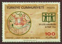
The Kashgari Map on a Turkish postage stamp
Two maps of particular importance in Kyrgyzstan’s history are the eleventh century map by Mahmud Barskan Kashgari (which can be found in the “Millet Genel Kütüphanesi” (the General National Library), in Istanbul, and was featured on Turkish postage stamp in 1972) and the Catalan Map of 1375 which associated the burial place of the evangelist St. Matthew with Lake Issyk Kul, (tradition identifies the burial place as Svetly Mys on the Northern shores of the lake).
Now Google Maps is a really useful tool and when it comes to Kyrgyzstan although, when it comes to Kyrgyzstan, it doesn’t have all of the features that are available in the UK … for example I can go back to the streets of Malvern where I grew up and switch between map view … satellite view and street view … and it’s surprising that, although there are some substantial changes, how much is still eminently recognizable.
Google are looking to open an office here in Kyrgyzstan and their Map Maker service looks quite promising – there are already several maps being created for Bishkek … marking the location of ATM’s, Bazaars and so forth.
I often use it for route planning and one of the features I find quite useful is the elevation profile – why not give it a go … learn about it here.
View Larger Map
An interactive map of Bishkek
You might also find this useful: maps.kg






 Bishkek