Sary Djaz
Recently there has been a lot of attention paid to the revival of an old plan to develop the Hydro Electric potential of the Kyrgyz Republic. Most of this attentian, of course, has centered on the Naryn Cascade – a series of dams to be constructed along the course of Kyrgyzstan’s longest river – the Naryn River – which is currently underway with assistance from Russia.
In some ways it’s a controversial project because the river is a trans-boundary river, (crossing the border with Uzbekistan), and some of the countries downstream, (the Uzbeks in particular), are concerned that the project will affect the flow of water which they need for irrigation purposes – although the Kyrgyz, Russians and Tajiks, (who have a similar project in the process of realization), are adamant that the project will not affect countries downstream and will, on the contrary, provide greater control.
Well, a week ago there was another project that hit the headlines – that of developing the considerable potential of the Sary Djaz river in Eastern Kyrgyzstan.
President Atambaev announced during the ceremony to mark the beginning of the Naryn Cascade that a memorandum will be signed during a visit to Bishkek by Xin Jiping, (the new Chinese President), on the construction of Hydro electricity plants along the course of the Sary Djaz river. The plan calls for three plants to be constructed (although I understand that the original plan was for five) and will help make Kyrgyzstan not only full energy independence but also enable it to become a major exporter of electricity.
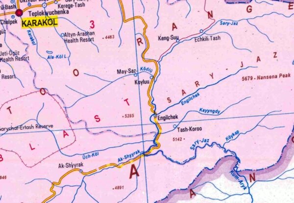
Map showing the course of the Sary Djaz River
The Sary Djaz river, (variously transcribed as Saryjaz, Sary Jazz and Sary Jaz), is in the remote Eastern part of the republic – in the in the Ak Suu, (White water), region of the Issyk Kul oblast. For almost 200 kilometers of its 282 kilometer length are in Kyrgyzstan.
Its headwaters flow from the melt waters of the Semyenov glacier on the North Western slopes of the Kan Tenir mountains, running to the West before turning South and is joined by its tributary, the Ak Shiyrak. It then breaks through the Kakshaal Too mountain range that mark the border with China. Flowing into the Chinese province of Xinjiang and the Tarim Basin. It flows through the city of Aksu after which the waters of the Toshkan join it and it skirts the Taklamakan Dessert before becoming a tributary of the Tarim River.
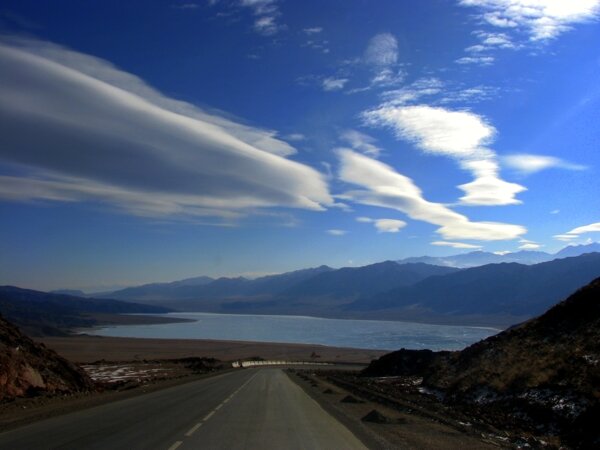
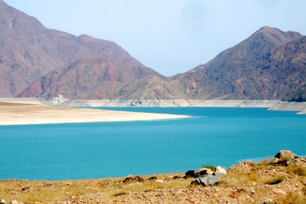
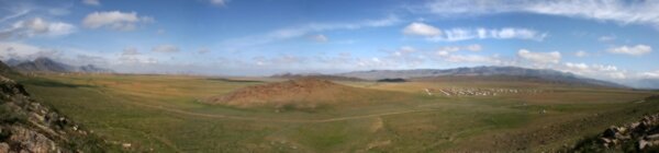
The region also has a large number of passes which are suited to trekking, offering a variety of levels of difficulty, with altitudes varying from four to over six thousand meters above sea level. The landscape and scenery can be dramatic, (ranging from gentle slopes with moutain pastures and groves of firs and spruce trees to canyon shaped valleys with steep sides – which may be ideal for the construction of hydro electric power stations), but access is difficult and combined with harsh climatic conditions, it all makes for this to be an unsuitable for all but the most experienced of travelers.
The valley is best approached by the road from Karakol up to the village of Enchilek.
However, even if a road appears on a map – there is no guarantee that it exists in practice. Many maps of the country still show the A364 road which looped from Karakol, through Enilchek, Ak Shyyrak, Yshtyk and KaraSai to the Barskoon valley and the Southern shore of Lake Issyk Kul – but in the early 1990′s a couple of bridges collapsed and have not been repaired … and, now, the complete loop from Karakol to Barskoon cannot be completed.
Because the region occupies an area that borders with China, access is limited and special “Border Zone” permits are needed to enter the area. Applications for these can take several weeks to arrange, so it’s a destination that requires a certain amount of planning.
It is quite a powerful river with an average flow of almost 250 cubic meters of water a second. This makes for some of the most demanding waters for white water rafting, canoeing and kayaking.
Although the river flows across the border into China, it’s not possible to cross here – well, not legally. Technically, it is only legal to cross the state border at specified “border crossings” – and with China there are only two: Torugart and Irkeshtam … both of which are a long, long, way away.
I am told that it might be possible to arrange special conditions, for an approved expedition for example … but, to be frank, we at Celestial Mountains don’t usually organize such “extreme” adventure tours, leaving that sort of trip “to the experts”. I am aware, however, of one group of kayakers who did try it … got themselves arrested in Aksu, received hefty fines and were then deported back to Kyrgyzstan … where the authorities were far from happy to see them.





 Bishkek