The Tien Shan Mountains
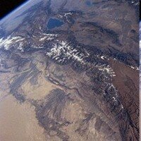
The Tien Shan is the largest mountain range in Asia, in surface area; length (2800km); and width (at one point reaching 800 km wide) – with a total of 40 peaks over 6000m.
It stretches across several countries and about much of the system lies in the territory of the Kyrgyz Republic. Extending over 2800km from the Chatkal range just East of Tashkent to Urumchi, (beyond which it rises again as the Bogdo Ola Range), they are usually described as being divided into Northern, Western, Eastern, Central and Inner ranges and most of them exhibit typical “alpine” features.
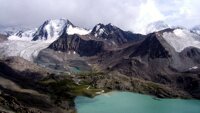
It is the central portion, south-east of Lake Issyk-kul is the highest and most majestic part of the Tien Shan mountain system, which extends for about 500 km from west to east and for 300 km from north to south, and contains the very high mountain peaks such as Khan Tengri and Peak Pobeda, closely grouped together along ridges that stretch east-to-west. The area surrounding the Enilchek Glacier has two peaks over 7000 meters, (Pobeda and Khan Tengri), 23 higher than 6000 meters including 3 virgin peaks – and 80 more peaks between 5000 and 6000 meters including 14 virgin peaks. It contains the ranges: Terskei-Ala-Too, Sarah-Dzhaz, Kui-Liu, Tengri-Tag, Enilchek, Kakshaal-Too and the Meridional Range. In the north, the Boro Horo Range connects the Tien Shan system with the Jungar Alatau Range.
The Western Tien Shan mountain system has fewer high plateaux: Palathon; Angren; Ugam and the Karzhantau. The highest points of the western Tien Shan are Chatkal Peak (4,503 m) in the Chatkal Range, Mount Manas (4,482 m) in the Talas Alatau and Mount Baubash-Ata (4,427 m) in the western part of the Fergana mountain range.
The range is made up of sedimentary, metamorphic and igneous rocks.
The existence of this great range, (also known as the “Celestial Mountains”), has been known since ancient times. Despite the records and observations recorded by many early travellers, however, until the expeditions of the Russian geographer and explorer Pytor Semyenov in the mid-nineteenth century, the Tien Shan Mountains remained “more legend than fact”. (Semyenov was granted the honorary title of “Tienshansky” by the Tsar for his exploits),
In fact the southern fringes of the system were first described by the Buddhist monk Hsuan Tsang in the seventh century BC, who wrote of ‘encountering nothing but ice and snow. The snow falls both in summer and springtime. Night and day the wind rages violently’. They also would have been visible to Marco Polo who (if we believe his account) travelled along this route in 1273, with his father and uncle.


 Bishkek