Where am I?
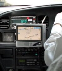
A GPS navigation system installed in a taxi in Kyoto
A couple of weeks ago, one of our staff walked into my office and asked: “What are the GPS coordinates for the Silk Road Lodge?”
“Ummm … I don’t know”, I had to admit – and then asked, “… why?”
It seems that we had a request from a group of clients who were driving a Camper Van, (RV to the Americans), through Central Asia as part of a journey along the the Great Silk Road. They will be driving in to the city and were going to be parking the vehicle at the hotel whilst the did the visa run at carious embassies here in Bishkek. They wanted the coordinates to help them find the hotel because they weren’t sure they would be able to find the place just from the address.
That was a good reason, but as we had no idea we had to see if we could find the co-ordinates pretty promptly.
For the record: Global Positioning Systems (GPS)is a navigation system based on a network of between 24 and 32 satellites orbiting the earth, which are able to provide location and time information in all weathers – provided there is ab unobstructed kine of sight to four or more of the satellites.
Satellite navigation systems were first established by the US government since as long ago as 1960, (although the first real GPS system began operating in 1973). It is of crucial importance for the military, but also has significant uses for private commercial users and is made freely accessible to anyone with an appropriate receiver. Mind you, it took a disaster for this to become official policy: the shooting down of a South Korean airliner in 1983 that had apparently “strayed” into Soviet air space – killing all 269 passengers and crew on board … including a US Senator.
As well as the American system, which is currently in its third generation, there are a number of rival systems being developed by Russia, Europe, India and China.
The system works by satellites continuously transmitting signals containing, the time of the transmission and the position of the satellite … the receiver then uses this information to calculate the distance between it and the satellite. In itself one signal is not enough in order to calculate a position, basically four are needed, (although in a few special situations – such ships on the high seas, (where altitude is not a complicating factor), three may suffice. However, the orbits of the satellites are arranged such that six will normally have an unobstructed view from almost everywhere on the earth’s surface. Whereas the original receivers were limited to four or five channels, (meaning that they could monitor four or five satellites at any one time), more modern receivers can have as many as 20 channels.
The positional date can be displayed as Latitude and Longitude either in standard degrees, minutes and seconds, North/South or East/West, (such as 74°35’27″E), or as a decimal value, (such as 74.5909292) and most receivers now incorporate mapping systems in order to display the data in a graphic format.
Now, GPS systems have been around for some time, and I have to admit they can be very useful. There are a couple of services that provide maps of Bishkek and the major road network around the country, but they haven’t yet extended into all the towns and villages.
For example, on more than one occasion I have hailed a taxi and said “Menye noozhen … “, (“I need – to go to …”), and been met with a blank look of confusion on the face of the taxi driver. Sometimes, I have this down to my accent or poor pronunciation – but at other times it’s because they don’t know where it is – they’ve never heard of it.
That’s not always that surprising … in the microdistricts an address can be simply 12-9 24 – that is: twelfth Microdistrict, building number 9, apartment 24. In itself that might not present a problem if they happen to know the twelfth microdistrict, but the buildings are not always arranged logically and on one occasion I spent almost an hour trying to find the relevant building – pointing to a building saying, “look, that’s building 8 so number 9 should be the next one … oh no, … that’s number 12 … so where’s 9, 10 and 11?”
If I happen to know where I am going – for example, I have been there before, then I simply sit down and say, “it’s all right, I’ll show you!”, but when neither the taxi driver nor I have any idea then we are stumped. Sometimes, the driver reaches for his City Atlas, (like an A-Z of Bishkek), and on one occasion when we were trying to find a night club on the outskirts of town to attend a Birthday celebration – we had to keep stopping and asking passers by.
Recently I have come across the odd taxi with a GPS system installed … and the driver has been able to punch in the address and then zoom in and out on a map to get his bearings … On one particular occasion this enabled me to get to a function at a school just a few minutes late … which meant I was I was actually in plenty of time – because, as is usual here, they started late. It seems that I was not the only person that was invited who had never been there before and couldn’t find it in the warren of back streets where it was located.
At the moment we don’t yet have systems to tell us about traffic flows and help direct us on routes to avoid traffic jams – but I am sure that will come.
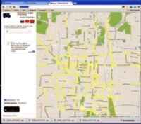
Bus.kg - a boon when it comes to making sense of Bishkek's Public Transport system
On a slightly different note: For locals there is are a couple of interesting websites – which can be accessed on tablets and mobile phones … including one to help people find which marshrutka (minibus service) to take in order to get from A to B.
It’s easy to navigate around the site and it certainly helps that the site is in three languages: Kyrgyz, Russian and English.
I tried using it to see how the kids can get between the office and their home – and I have to admit that, for the first time, I think I began to make sense of the maze of different routes that ply across the city.
It not only tells you if and where you have to change buses but even estimates how long it will take you to walk from the start point to the first bus stop and from the last bus stop where you leave the marshrutka to your final destination.
.
Oh, yes … and for those who are interested … here are the GPS coordinates for our offices and our two hotels:
|
Landmark |
Address |
Longitude |
Latitude |
||
|
The Celestial Mountains offices |
Kievskaya 131, Bishkek |
74°35’27″E |
74.5909292 |
42°52’31″N |
42.8755553 |
|
The Silk Road Lodge |
Abdumomunova 229, Bishkek |
74°35’37″E, |
74.5938689 |
42°52’48″N |
42.8801979 |
|
The Celestial Mountains Guesthouse |
Razzakova 42, Naryn |
76°01’17″E |
76.0214639 |
41°25’44″N |
41.4289642 |



 Bishkek