The Silk Road through the Chui Valley
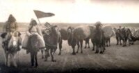
An early 20th-century Oirat caravan, traveling on horseback, possibly to trade goods.
Today is Mezhdunarodniy dehn karavanshika – The International Day of the Caravan. This is not one of those international commemorative days established by the United Nations or one of their agencies … but a “professional holidays” for truck drivers, “teamsters”, crews of merchant vessels and escort ships, established in 1995 by the International Association for the rationalization of transport and cargo handling, the International Cargo Handling Co-ordination Association, (ICHCA).
It’s not exactly clear why this particular date was chosen … there are two versions:
- It is the birthday of William Adams, (1564-1620), (although to be honest, nobody knows the actual birthday, this was the day he was christened). He was a British sailor, explorer and navigator who had served against the Armada – and is generally considered to be the first European – at least the first Briton – to reach the coast of Japan, in April 1600. Adams lived in the Land of the Rising Sun for 20 years, playing a large role in the development of trade relations between Japan and England and Holland. His story is told in James Clavell’s novel, Shōgun.
- According to another theory, however, the day commemorates the end of the Hijra – a holiday in honor of the relocation of the Prophet Muhammad and the first Muslims, from Mecca to Medina.
The word “caravan”, of course, originally meant a group of people traveling together, and their pack animals: camels, horses and donkeys. Typically, traders united in this way for mutual assistance and support when traveling though dangerous areas. The most famous caravan route of all time was probably the Silk Road connecting China amd Europe through Central Asia.
Subsequently, the name of the “caravan” spread to mean any convoy of transport carrying loads over long distances.
Unlike neighbouring Uzbekistan, Kyrgyzstan is not particularly well endowed when it comes to architectural remains of the great cities of the Silk Road – or even ruins. There is nothing like the Registan of Samarkand. There is, however, plenty of evidence of the Silk Road passing through the country … in documents and as the result of archaeological excavations.
However, the area known as Semirechye, (Seven Rivers), is rich in evidence of settlements that thrived on the activity that took place along the ancient trade route.
The early Middle Ages, saw the arrival of Turkic nomadic tribes who began settled communities in places throughout the Talas and Chui valleys and the Issyk Kul basin; sometimes on the site of earlier settlements established by the Usuns and Sogdians – although, later on, settlements grew up in new locations.
Historians have identified something like 80 communities in the Chui valley alone. Eighteen of them were large cities occupying between 15 to 30 square kilometers and with long walls surrounding them. These cities were often something like 15-20 kilometers apart, the equivalent of a day’s travel for the caravans that traversed the Great Silk Road – and there were often smaller settlements in between them.
Names which have come down to us, such as Aspare (near modern day Kaindi), Nuzket (Kara Balta), Djul (Bishkek) are just that – names. Many of the ancient towns and cities which graced the Silk Road have disappeared, others have modern cities built on or near the sites where they once stood.
Some of the more important settlements were:
Nuzket:
Also known as Shish Tube – is located in the Northern suburbs of Kara Balta and seems to date back to the 6th century and was mentioned in historical records from the 10th and 12th centuries, when it was destroyed by the Mongolians.
The central part of the settlement held a citadel, a shakhristan (the town itself – housing, shops, temple, workshops, etc.), occupying almost 50 square kilometers surrounded by a strong defensive system including two, (or three), rings of fortified walls.
Six centuries later, the Kokands built the Shish Debe fortress on the site for keeping control over the Western Chui valley.
Kyzyl Suu:
The settlement of Kyzyl Suu was located between the modern villages of Sokuluk and Novoprovka, and is interesting because a wide range of artifacts that were discovered here by archaeologists, (coins, inscriptions, armour, jewelry and large pieces of silverware), but unfortunately many of them have since disappeared – transferred to museums elsewhere and so on.
Djul:
A Sogdian city on the Great Silk Road – between the sixth and twelfth centuries – on the site of what is now the capital city, Bishkek. Although archaeological excavations have recovered artifacts, all traces of this city have now disappeared.
It took the form of a walled quadrangle, occupying an area between the modern streets Orozbekova, Lenigradskaya and Kirova.
A varied population included Zoroastianists, Buddhists, Nestorian and Manichean Christians. The Mongols under Genghis Khan destroyed it.
Tarsakent:
Вetween Djul and Nevkat, (but a little South of the direct route taken by today’s road, near the modern day village of Karadjigach), was a town called Tarsakent – which is sometimes translated as “Christian Town” because a large number of Nestorians are thought to have lived here. Indeed, something like 700 Nestorian inscriptions on things like gravestones have been found in the area around Bishkek.
Among other archaeological finds have been a large of coins.
The city was at one time the capital of Haidu Khan, (1269-1301), who apparently ruled over a territory stretching as far as the Amu Darya.
The city escaped destruction by the Mongols and survived until fourteenth century, becoming a center for craftsmen of all sorts, although most of the citizens seem to have reverted to a nomadic way of life breeding cattle. This helped to shape the economic-cultural type of population for other five centuries and the return to shamanic-pagan cult.
Nevkat:
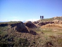
What’s left of the Silk Road city of Nevkat – an archaeological site at Krasnaya Rechka
About 35 kilometers to the East of Bishkek, and 8 kilometres East of Kant. lies the modern village of Krasnaya Rechka (=”Red River”). This is the site of the ancient towns of Saryg and Nevkat (=”New City”), a Silk Road city that flourished between the Sixth and twelfth centuries. The identification is based on manuscripts found at the site.
By all accounts, Nevkat was a major metropolis. Indeed, it was probably the largest of all the medieval cities in what is now Kyrgyzstan – and, according to one author, was the “most north-easterly of the central Asian ‘super cities’” and was, at one time, “one of the world’s most important trading centers”.
Founded by the Sogdians, (an Iranian speaking people), in the fifth century, in the seventh and eighth centuries it boasted a population of 100000. It had over 18 kilometers of city walls, (as long as those of ancient Rome), which enclosed an area 25 square kilometers. Inside these walls were public buildings, markets, gardens and even farms.
In the North-eastern part of the city was a vast citadel, built on a massive artificial platform – which is all that remains easily visible today. Measuring some 800m across and 20m high – 30m in the extreme South-Eastern corner where it is thought the ruler’s palace was located, the mound comprises some 13 million cubic meters of earth and mud bricks, it is five times the size of the Great Pyramid of Cheops in Egypt and it, apparently, is the largest man-made mound in the world. It has been estimated that a workforce of several thousand must have been employed in its construction – which could have taken a decade, or more.
This citadel was almost certainly an “upper town” for the ruling elite of the city – probably Sogdians. However, it was not a mono-cultural city. A necropolis showed signs of a number of different funeral techniques and traditions. Other peoples who are thought to have populated the city include Chinese, Uighurs, Tibetans, Persians as well as the local Saks. Archaeologists have found artifacts showing that Buddhists, Zoroastrians Nestorians, Manicheans and pagans all thrived here.
Particular archaeological finds have included: the remains of a large sculpture of the Buddha, which would have stood 12 meters high when complete, which were discovered in the corridors one of the two Buddhist temples uncovered. Also shards of 1000 year old pottery litter the site.
All that remains today are irregular mounds and a couple of eroded clay walls of the ancient fortifications, but, as Daniel Prior writes in “The Bishkek Handbook”: “ “For those who are able to sightsee without seeing standing buildings, Krasnaya Rechka – prettier in setting and more conducive to contemplation than the history-factory at Burana – offers a subtle vista on the past. From the summit of the citadel, where the ground underfoot is thickly strewn with pieces of thousand-year-old pottery, on a clear day, you can see almost to Ch’ang An and Byzantium.”
Those travelling from Bishkek to Issyk Kul on the new road that bypasses the villages and the towns of Kant and Tokmak, will be able to see mound of the citadel and the embankment that marked the site of the old town rising from the Chui plain.
Suyab:
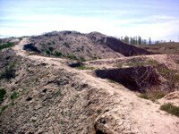
Suyab – outside Tokmok … One of Kyrgyzstan’s active archaeological sites
Situated on the eastern edge of Tokmok – about 9 kilometers from the Bus Station on the main Bishkek road, just outside the village of Ak Beshim is archaeological site of Suyab – which, as the capital of the Turkic territories between the 6th and 10th centuries, was one of the most important trade and cultural centers in the Chui valley, inhabited by the Turks and Sogdians.
Archaeologists date the origin of the town to the 5th and 6th Centuries. It was, in fact referred to by the Buddhist monk, Tripitaka (602-644), in his account of his travels. It later came under Arab influence and faded into history in the period between the 10th and 12th centuries.
Several excavations have conducted and revealed much about the thriving city. It was a walled settlement. There were paved and pebbled streets, water pipes made from tiles, Buddhist temples a church and a fortress. There were numerous mansions, and a Christian cemetery and funeral complex, around the Sacristan, which stood at the center of the town.
Two Buddhist temples, about 250 meters apart, have been excavated. The first one, about 100 meters south east of the citadel, was excavated in 1953-4 and was about 22 m by 76 m. The entrance was on the eastern side and led to a courtyard and the main hall used for prayer had four clay statues of the border mounted on high pedestals. There was also a bronze statue in the central sanctuary. The walls and ceiling shows signs of highly ornate painting. The other temple was excavated in 1955-8 and measured about 38 m square. The entrance was on the northern side and was flanked by two pillars. The main sanctuary was in the form of a cross – each arm, or niche, having pedestals for the statues of deities. The Southern niche – opposite the entrance – housed a statue of the Buddha.
The 7th century church was also in the shape of a cross and had an open yard in front of it.
These buildings and the artefacts found in them provide evidence of the level and quality of the architecture, painting and sculpture prevalent at this time – and in many ways they are reminiscent of similar structures found at other points on the Silk Road – pointing to the range and influence of this ancient trading route on the communities which were spread along its path.
Today, however, all that remains are eroded ridges and grass covered mounds – and a couple of signs at the entrance to the site.
Oddly enough, many locals refer to this as Balasugan – although all the authorities say that nearby Burana was the proper site of Balasugan.
Balasugan:
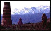
Balbals, Tower and Mountains
Situated 10 km to the South of Tokmok – stands the Burana tower. In fact the tower is all that remains of the ancient city of Balasugan set at the foot of the Shamshy valley. Established in the 10th century on the site of an older settlement, the city was the birthplace of the poet Jusup Balasugyn (1015-?) who wrote an epic poem called Katadgu Bilim (=”The knowledge which brings happiness”), which has been translated into several languages – including a recent translation into English by Walter May.
With Kashgar, Balasugan was one of the capitals of the Eastern Khanate when the Karakhanid state split up. (The capital of the Western Khanate was Samarkand). It was spared from destruction by Genghis Khan’s Mongols, and renamed Gobalik (=”good city”) in the 13th century, but it lost its importance and had disappeared by the 15th century.
There were major archaeological surveys of the site in the 1920s, 1950s and 1970s. The archaeologists discovered that the town had a complicated layout covering some 25-30 square kilometers. There were ruins of a central fortress, some handicraft shops, bazaars, four religious buildings, domestic dwellings, a bathhouse, a plot of arable land and a water main (pipes delivering water from a nearby canyon). Two rings of walls surrounded the town.


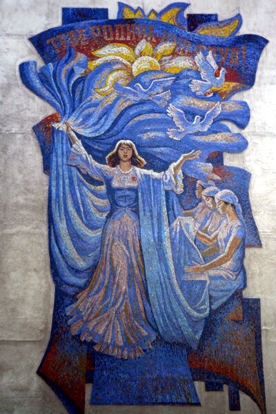


 Bishkek