The Naryn River
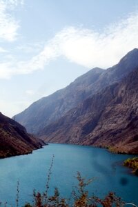 The Naryn River is also known as the Alabugatuz - although that is actually one of the major tributaries. In fact, the river has several names that are applied locally along different stretches of its course)
The river rises in the Tian Shan mountains in Kyrgyzstan, flows West and then South into the Fergana Valley and Uzbekistan, where it merges with the Kara Darya River to form the Syr Darya.
At just over 80o kilometres long (that’s just over 500 miles) it is Kyrgyzstan’s longest river.
The watershed covers almost 60,000 square kilometers. Among the largest tributaries that feed into the river are the Kichi-Naryn River, (or Malie Naryn – the Little Naryn River, which merges with the Chon Naryn – or Big Naryn River – to the East of the city of Naryn); the At-Bashi; On Archa; Kadjyrty; Chichkan; Alabuga and Kekemeren Rivers.
The head waters of the Naryn River rise in a remote high altitude, treeless basin, (The Taragai Basin), located “pretty much in the middle of nowhere between lake Issyk Kul and the Chinese border” – it’s actually in the border zone and a permit is necessary to visit the area. The river leaves the basin and flows though a valley that narrows into gorges, (creating the first of many rapids along the course of the river), interspersed with stretches of flat land on the immediate banks of the young river.
The river contains many reservoirs which are important in the generation of hydroelectricity. The largest of these is the Toktogul Reservoir in Kyrgyzstan containing 19.9 cubic kilometres of water, (that’s almost 20 million cubic liters).
Upstream from the Toktogul reservior are the Kambarata-2 and At-Bashi Dams and work is currently underway on the Kambarata-1 and Kambarata-3 Dams and Hydropower stations.
Downstream are the Kurpsai, Tash-Kumyr, Shamaldysai and Uch-Kurgansk Dams.
It has been reported that the Russians, who are basicaly funding the Kambarata projects, are interested in the construction of a total of eight hydropower plants on the river – implementing a planned “cascade” that was first proposed in the Soviet time.
The river is also important for irrigation, and feeds the Bolshoi Ferghana and Northern Ferghana Canals.
It flows through picturesque, if not dramatic landscapes; through both narrow gorges and wide plains. There are roads that follow the course of the river for part of its course, but there are other sections which are almost inaccessible.
In the upper part of the River, to the East of Naryn, there is the Naryn State Reserve – a National Park which was founded in 1983 and covers an area of over 90 million hectares and is hoped to help protect the coniferous forests, alpine meadows, and other ecosystems it contains. The river flows for 120 kilometers through the reserve and is is between 30 and 40 meters wide.
The middle part of the river’s course includes the Naryn Bolson – an intermountain depression which contains the city of Naryn where the river is 45 meters wide. It lies at an altitude of about 3000m and stretches for about 300 kilometers, and is up to 50 kilometers wide.
As the river continues its descent towards the Toktogulk Reservoir, to the left, (South) is the Naryn Too mountain range. (Too means colourful in Kyrgyz, but when referring to mountains it indicates that the peaks are permanently covered in snow). The range is about 130 kilometers long and rises to a maximum height of 530m. The northern slope of the range is steep with rocky gorges, whilst the the southern one is flat consisting of clays and sands. There are fir forests growing here and there in the gorges which tend to be short (only about 10-15 kilometers long), shallow and stony.
There are several dramatic systems of gorges, (such as Akshirakskoe, Trudnodostupnoeusheli – Hard to Reach Gorge, Shiveristo and Kambarata Gorges), interspersed with more densely populated areas around such as around Naryn and Kazarman.
The river has great potential for rafting and some companies offer itineraries that vary from 2-3 days to 3 weeks or more. It’s not, however, a calm or quiet river … although it may seem like that when seen from the roadside … it can be violent and unruly and meandering with steep drops, rocky beds narrow channels. The river itself freezes over during the winter months and the ice can reach a thickness of 80 to 120 cm. High water occurs in May when the ice has melted and flow increases thorough the summer months. Being fed in the main by glacier melt waters, the morning-evening water fluctuations vary upon several factors – although they can be marked on the tributaries, (even the Kichi Naryn which contributes about a third of the total flow), they hardly exist along most of the main river, due to its length.





 Bishkek